Contact us

Navigate safely during GPS
spoofing and signal disruption

Keep vessels safe in high-risk zones

GPS spoofing is increasing across major shipping routes. When GPS is manipulated, AIS and ECDIS become unreliable, leaving crews to rely mainly on radar and visual watchkeeping - conditions that can quickly erode situational awareness and create high-pressure situations on the bridge. Orca AI enables GPS spoofing detection and provides an independent visual reference of surrounding traffic to support safe navigation.

Maintain safe navigation during signal disruption

Preserve reliable situational awareness even when GPS or AIS data becomes unreliable.

Increase crew confidence

Receive real-time alerts when entering spoofing zones so crews understand the situation, know shore teams are informed - providing reassurance in high-risk areas.

Avoid operational disruption

Adjust route if possible and allow the crew to better prepare by getting alerts from other vessels in the area ahead of time.

Maintain awareness through visual detection

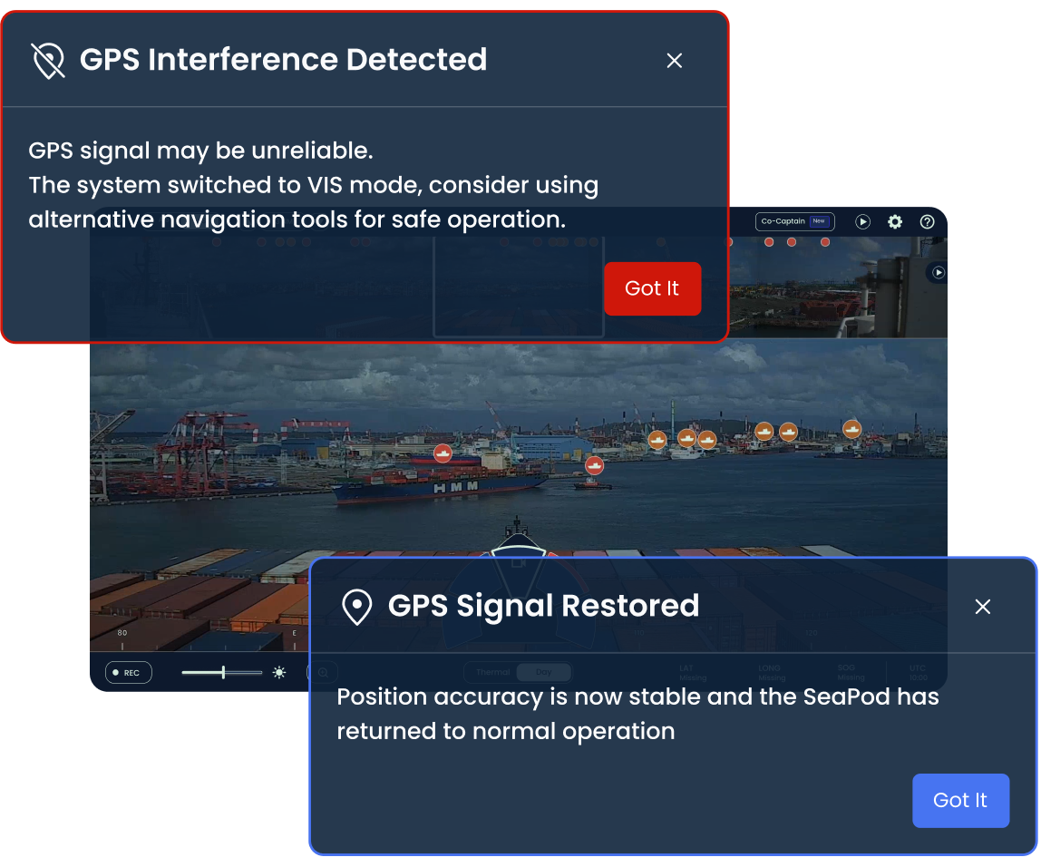
Receive automatic alerts when GPS jamming is detected

Orca AI detects spoofing through sensor inconsistencies, validates it in the cloud, and alerts the vessel when spoofing is detected and when reliable GPS positioning is restored.

Detect and classify targets without relying on AIS or GPS

The Orca AI SeaPod digital watchkeeper detects and alerts on all types of targets without relying on AIS signals or GPS data, maintaining situational awareness and reducing vulnerability during GPS jamming events.

Notify shore teams for fleet monitoring

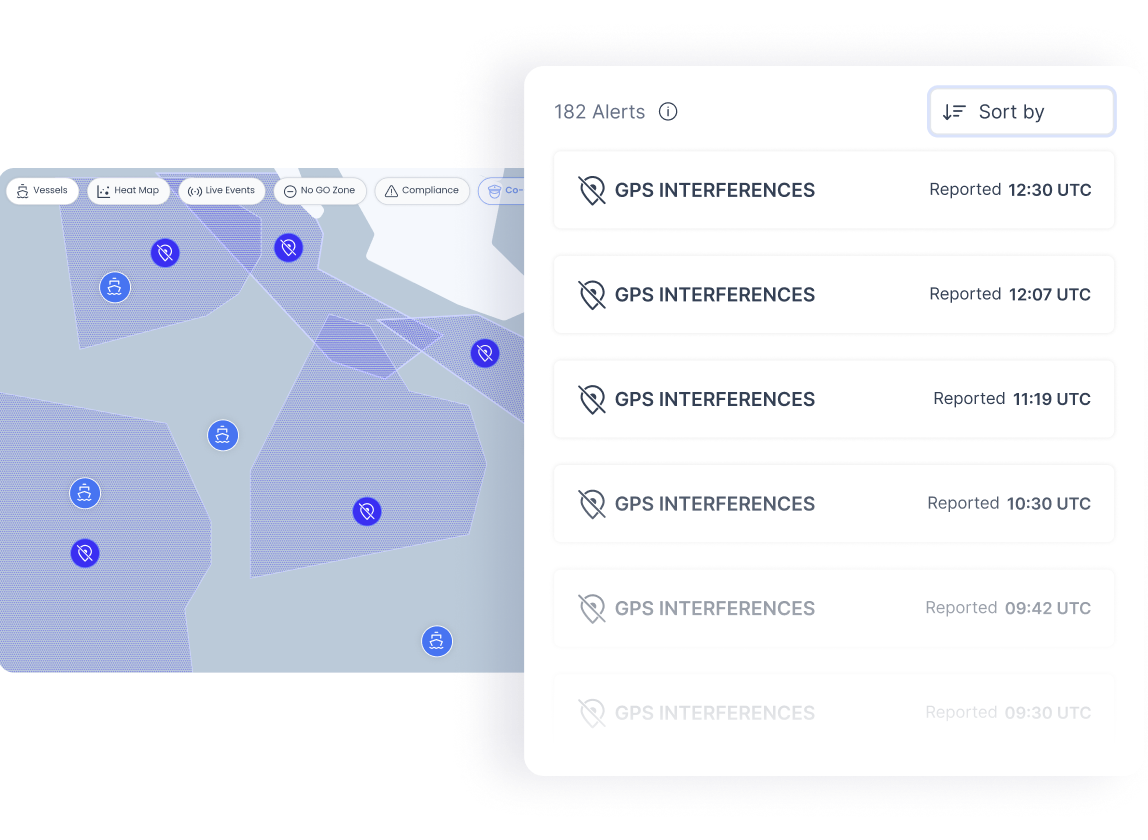
Operations teams ashore can surface GPS jamming alerts in FleetView to monitor affected vessels and support and adapt operations during signal disruption

Share GPS spoofing alerts with nearby vessels

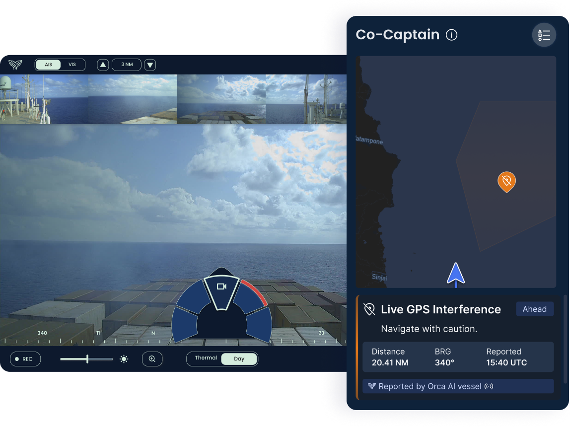
Distribute spoofing alerts through Co-Captain to nearby Orca AI equipped vessels, allowing them to anticipate disruption before entering the area, using the last verified vessel position rather than manipulated coordinates.

Detect non-AIS targets

Detect and classify non-AIS targets such as fishing boats, small craft, and other untracked vessels with machine vision and multi-sensor fusion, maintaining reliable awareness even when identification signals are absent or unreliable.

FAQs

How does GPS spoofing affect situational awareness on the bridge?
GPS spoofing affects bridge situational awareness by corrupting the position data that AIS and ECDIS depend on. Nearby traffic may appear in the wrong location or disappear from the chart entirely. Bridge officers are left navigating on radar and visual watchkeeping alone, with no independent reference to validate what they're seeing.
How does Orca AI detect GPS spoofing on board?
Orca AI detects GPS spoofing by cross-referencing the GPS signal against other onboard navigation sensors. When the inputs don't match, the discrepancy is processed and validated in the cloud. Once GPS spoofing is confirmed, an alert goes to the bridge before crews start making navigation decisions based on manipulated coordinates.
How does SeaPod maintain situational awareness during GPS spoofing when AIS and GPS fail?
SeaPod maintains situational awareness during GPS spoofing because it's a stand-alone computer vision sensor, unaffected by GPS or AIS failures. When GPS interference is detected, it automatically switches to VIS mode and continues tracking all traffic, including non-AIS targets like fishing vessels and small craft. GPS spoofing disrupts the data layer; it doesn't disrupt the camera.
How are GPS spoofing alerts shared with nearby vessels?
GPS spoofing alerts are shared with nearby vessels through Co-Captain. When one Orca AI-equipped vessel detects GPS spoofing, the alert is shared in real time with other Orca-equipped vessels on the same route, giving ships advance warning before they enter the affected area.
How do shore teams monitor vessels during GPS spoofing events?
Shore teams monitor vessels during GPS spoofing events through FleetView, which surfaces GPS spoofing alerts to operations teams ashore. Teams can see which vessels are affected, track them during the disruption, and coordinate support, particularly for fleets operating in the Black Sea, Red Sea, or Persian Gulf where GPS spoofing is an active risk.
See all FAQs

Take shipping operations to the next level. Today.

Contact us and learn how cutting-edge AI and computer vision can help you take your fleet’s operations to the next level.

Contact Us